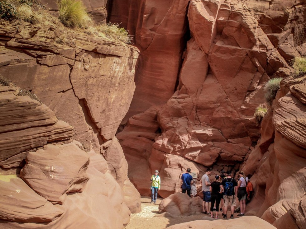
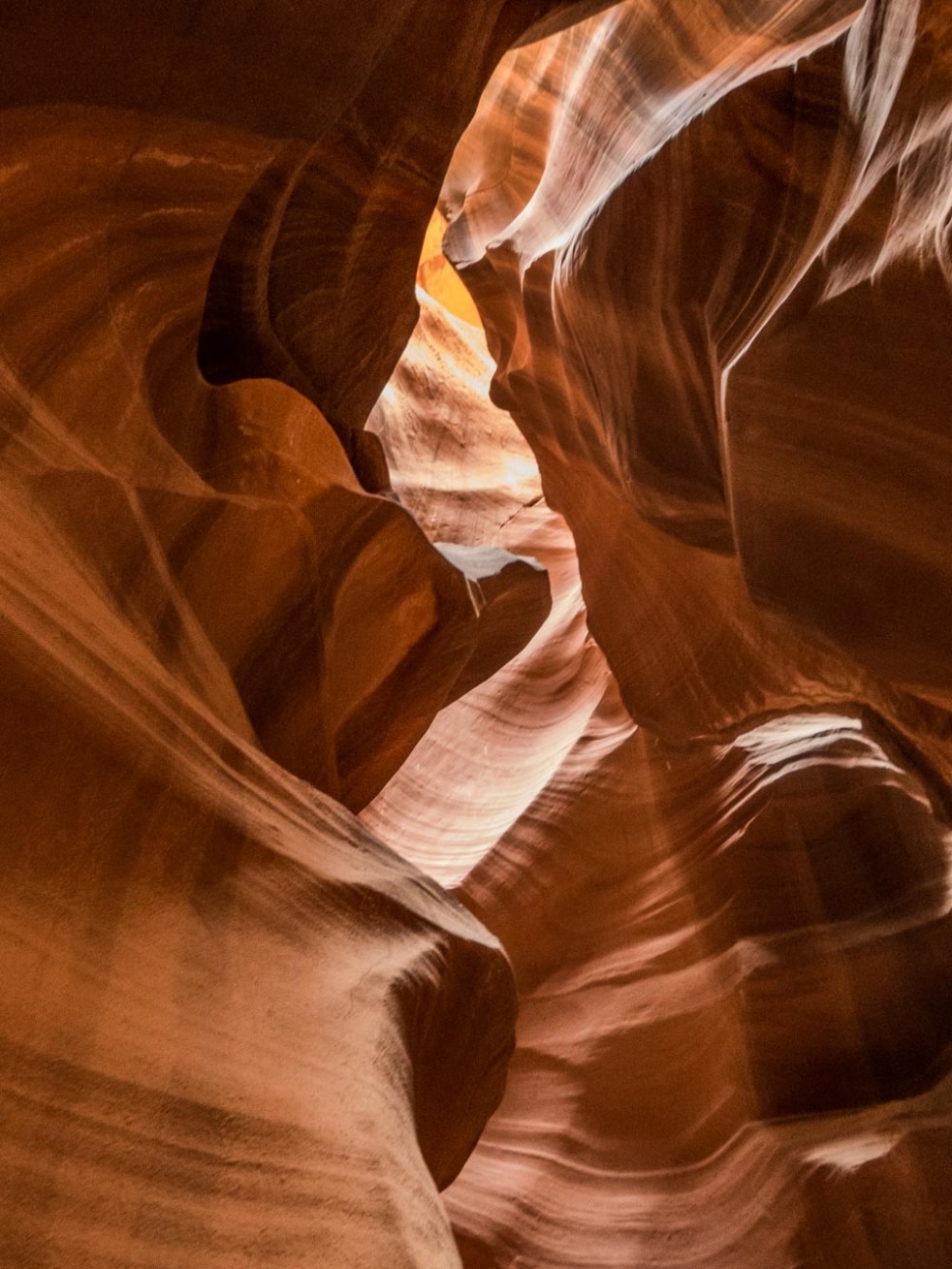
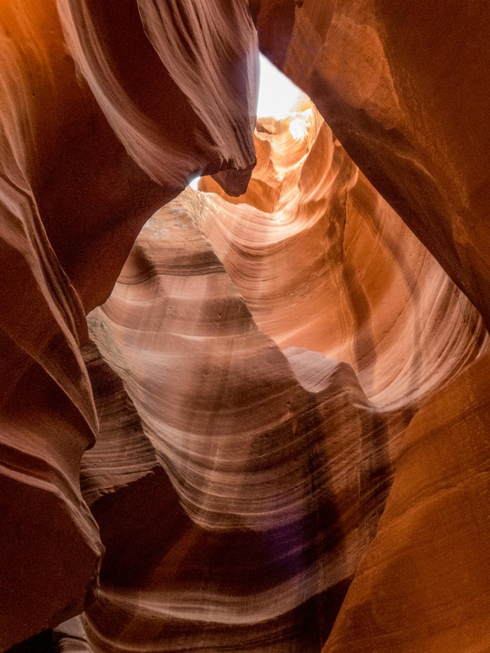
I had seen photographs so wanted to go, but not without apprehension. Tours of Antelope Canyon are led by guides from the Navajo Nation, on whose land the slot canyon is located near Page, AZ. I’m not one for tight spaces, nor do I much like deep dark caves, so we opted for the tour of Upper Antelope Canyon, which requires walking into vs. descending into the canyon (the Lower Antelope Canyon tour). A four-wheel drive vehicle delivered us along a dry riverbed to the mouth of the canyon, from where we were led into the stone maze in small groups. There are some tight spaces, too many people, and places where two persons passing must do so back to back. But the guides do a masterful job of moving crowds along, and are in touch with weather trackers to ensure a flash flood doesn’t come as a very unwanted surprise.
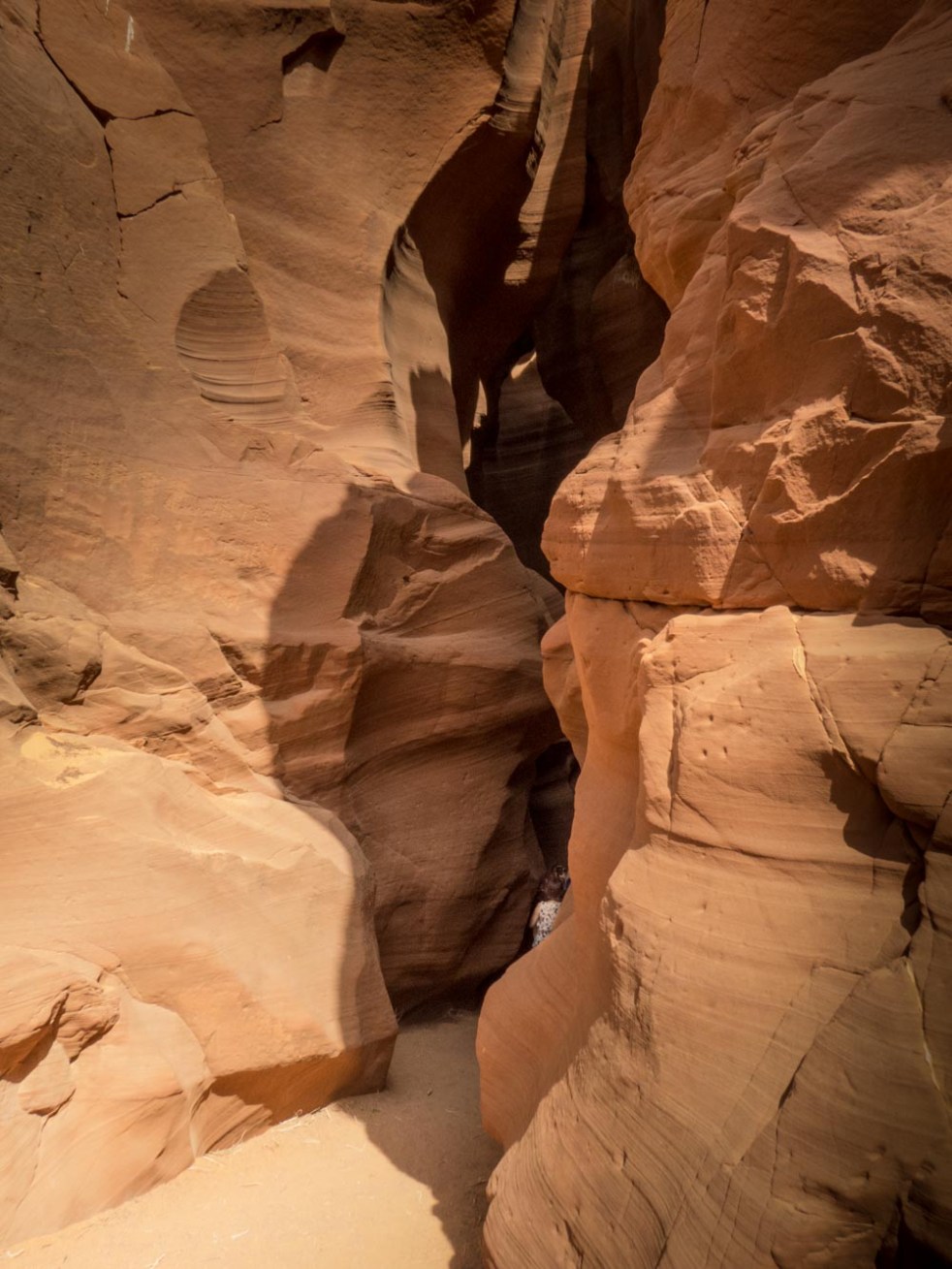
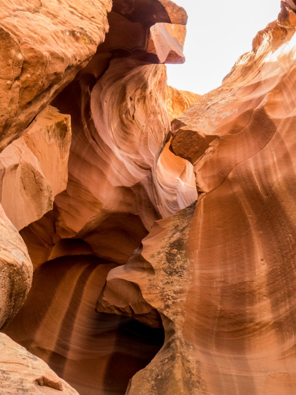
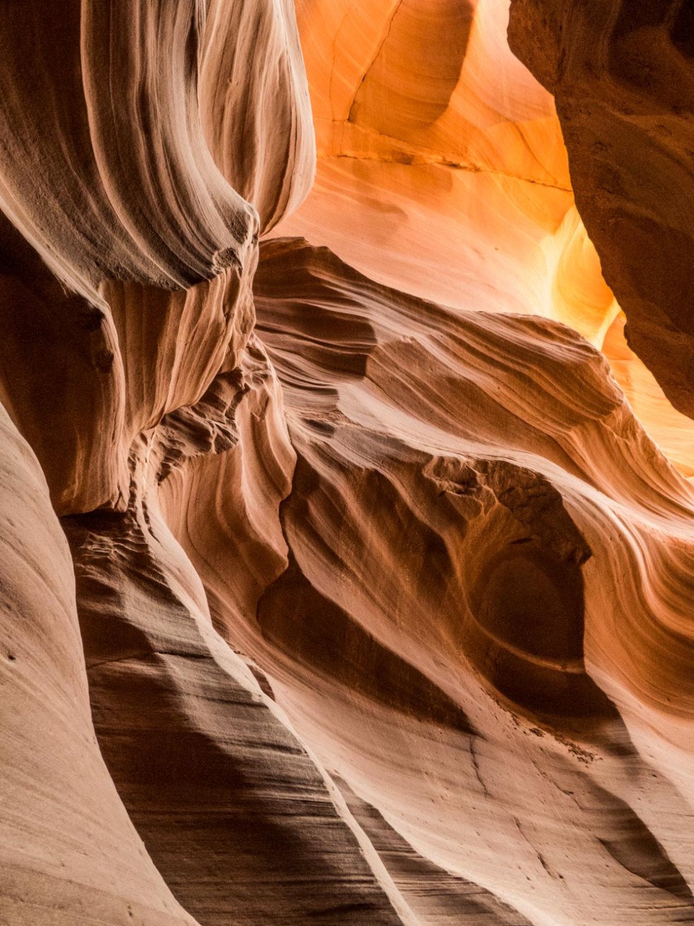
You can’t blame people for “stop dead in their tracks” stupefaction. I was one of them. From the gathering location outside the entrance slot, it is impossible to imagine what’s ahead. In the second shot, look for the woman entering the canyon at the bottom of the photo to get a clue as to scale. The third photo, still outside the canyon, begins to introduce what’s coming. Then the real fun begins. Shots are taken leaning back and looking up into shafts of changing light; flood debris can occasionally be seen caught in crevices far above one’s head. Beautiful now…


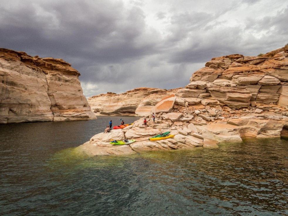
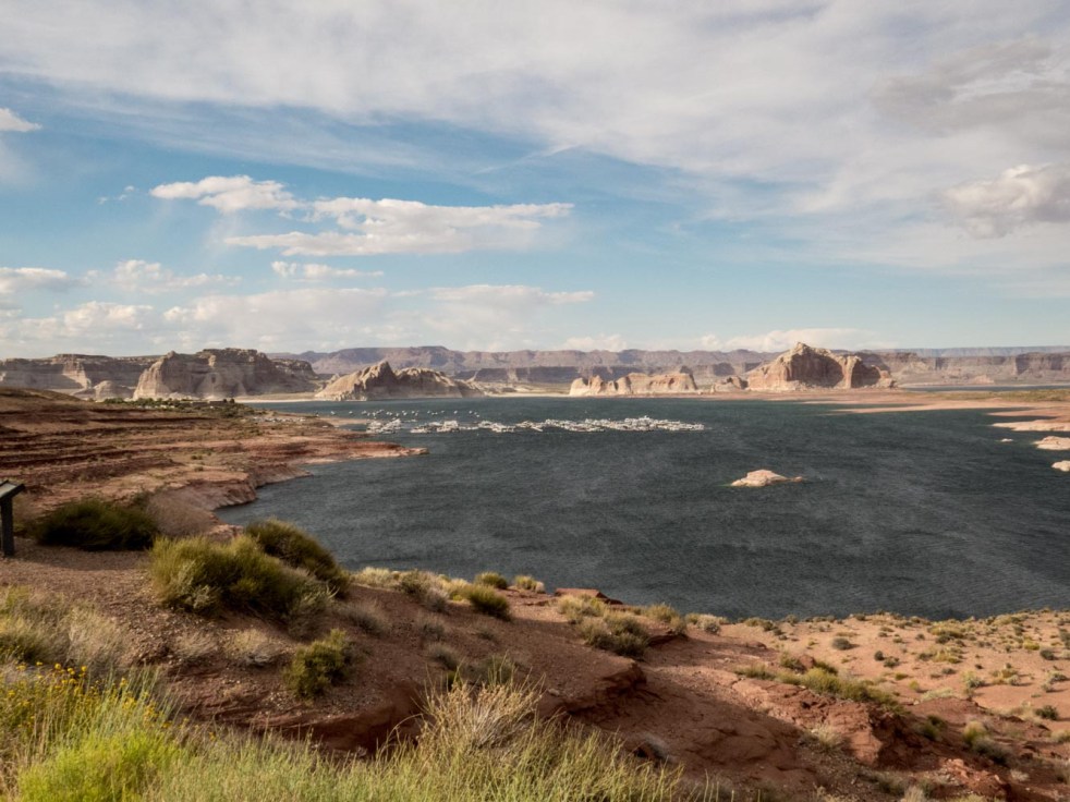
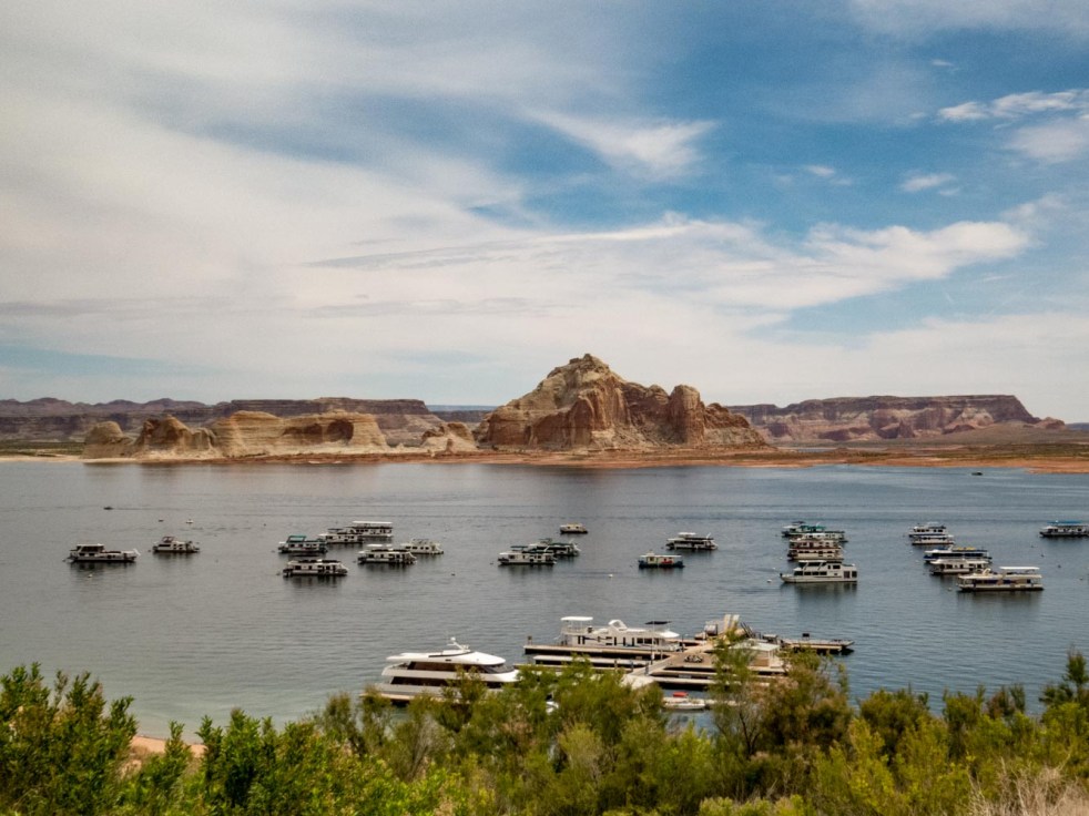 Yes, this is still our Arizona-Utah National Parks trip (will it ever end, you ask? Not quite yet..!) We changed our pace for several days in Page, AZ, enjoying Lake Powell and the Glen Canyon National Recreation area. After the desert landscapes of Utah, it was impossible not to be captured by the water. We opted for a boat cruise into narrow, winding Antelope Canyon to see its red and orange Navajo sandstone formations, and got caught in the rain you see threatening us. Kayakers in the canyon were also pummeled, which seems to be a price one pays for adventuring on the lake. The afternoon cleared into a beauty of an evening.
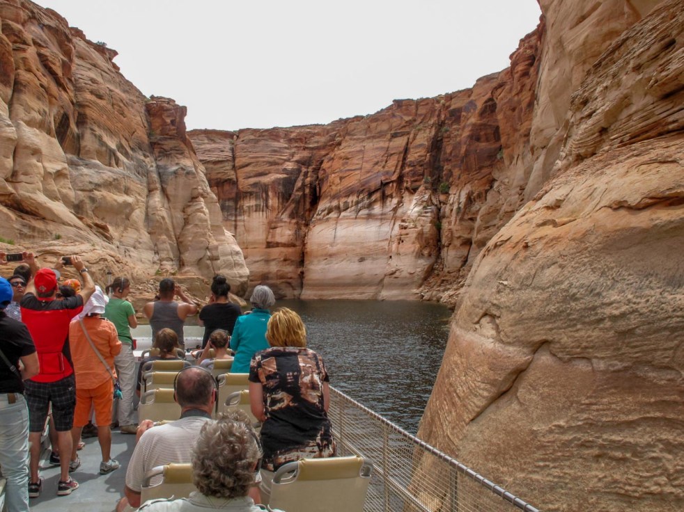


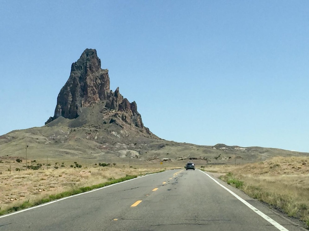
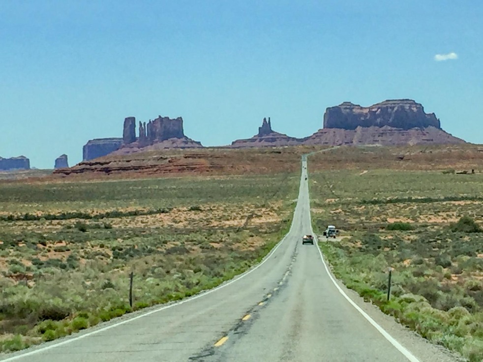 Growing up on the East Coast, the West I knew was brought to me by movies and television, which imprinted tall tales with wild scenery. The”deja vu” sensation surfaced the moment we entered the Navajo Nation Tribal Park, which crosses the Utah/Arizona state border. The area known as Monument Valley has been a favorite location for iconic westerns since director John Ford filmed “Stagecoach”there in 1939, and has continued to offer stunning backdrops for filmmakers and tourists alike. Are the monuments and earth colors purple? red? brown? orange? grey? green? Yes. We stopped often just to make sure we were seeing what we thought we were seeing.


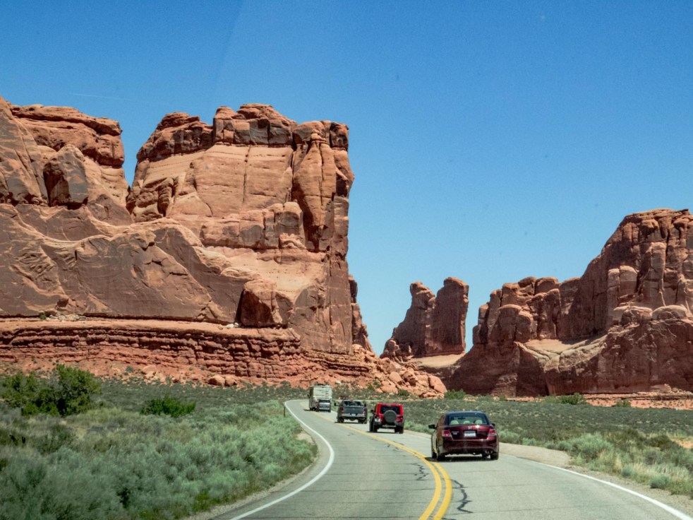
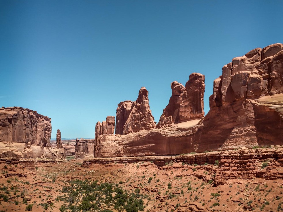


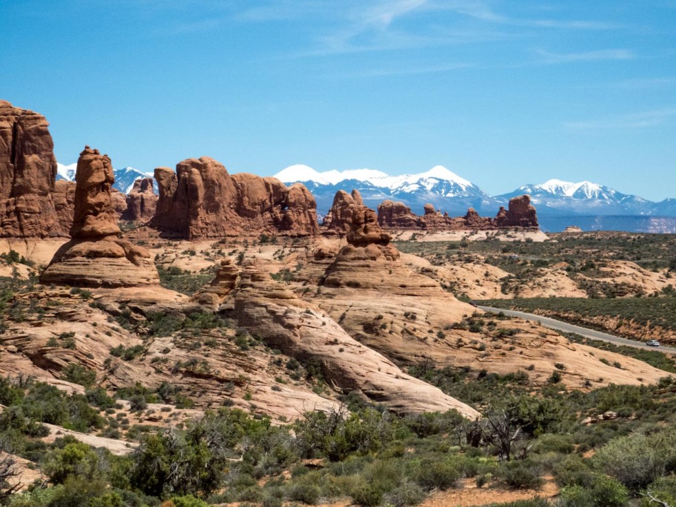
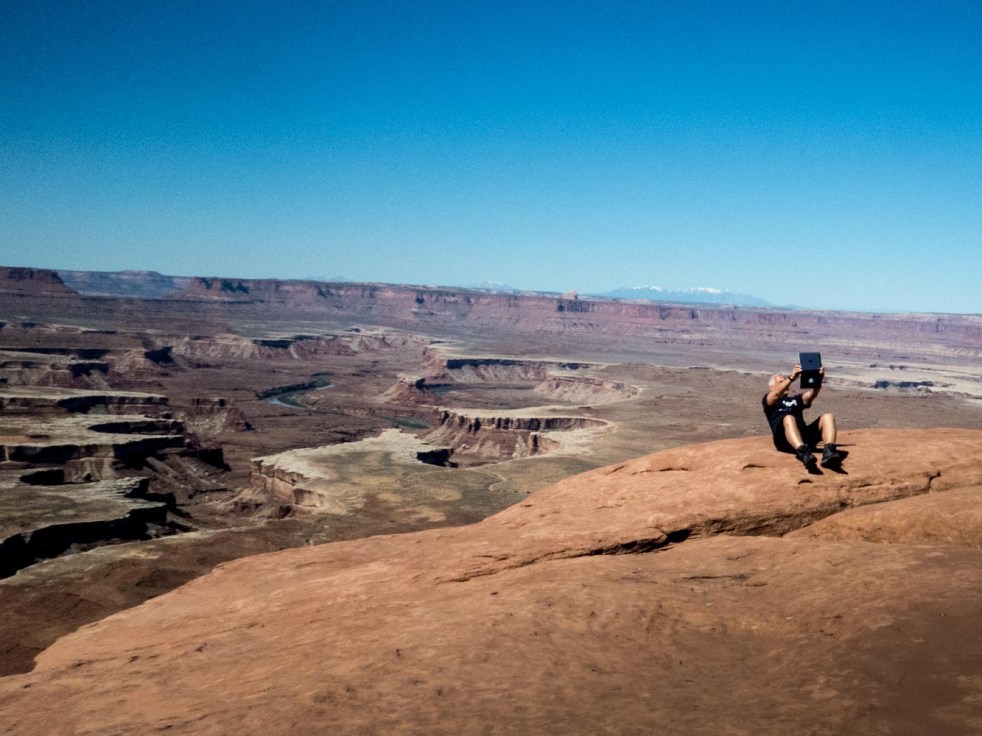
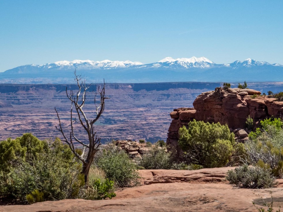 Canyonlands National Park is a weirdly wonderful place. We visited only its northern district near the town of Moab, but read that it stretches into three other completely unique districts over a large portion of southeastern Utah. The park provided outstanding opportunities for both selfies and reflection (but not for us; those soft cliff edges and long drops deterred our participation). We just enjoyed looking at it (and them).


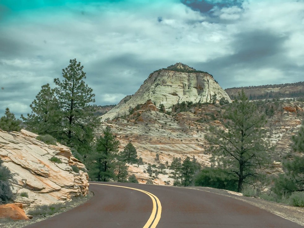
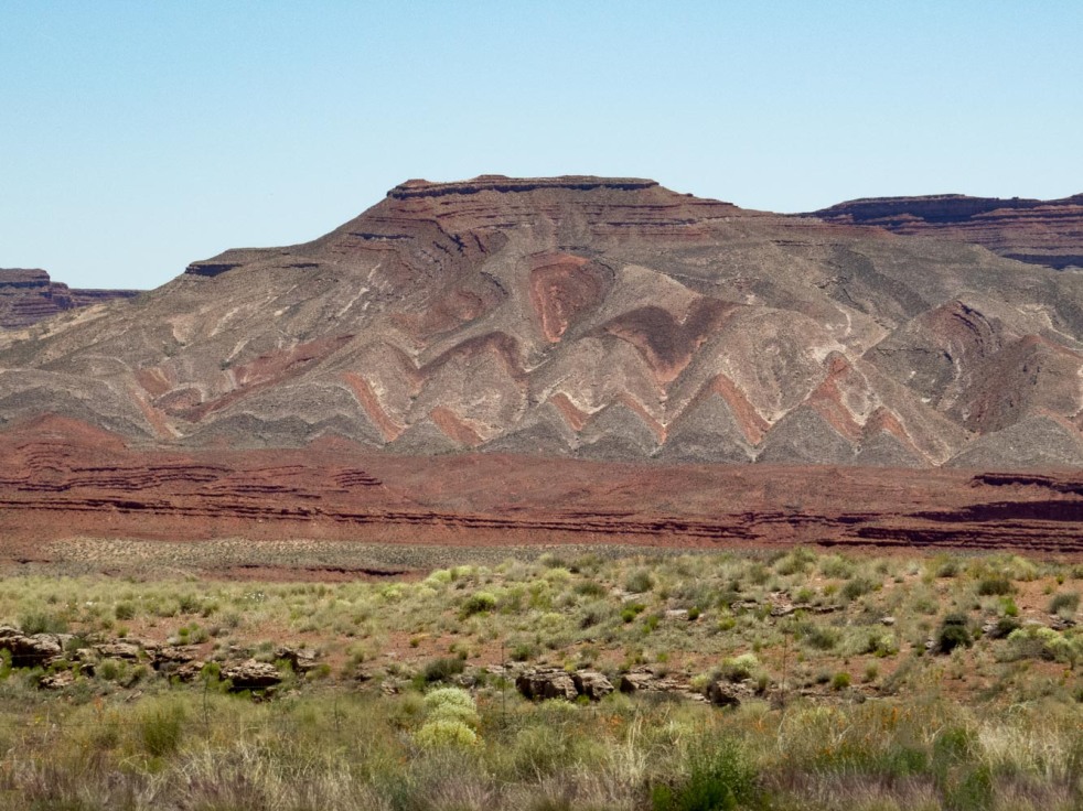
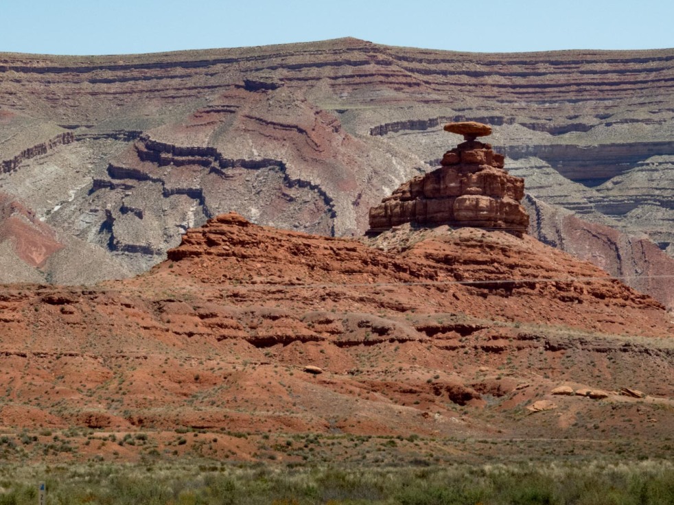
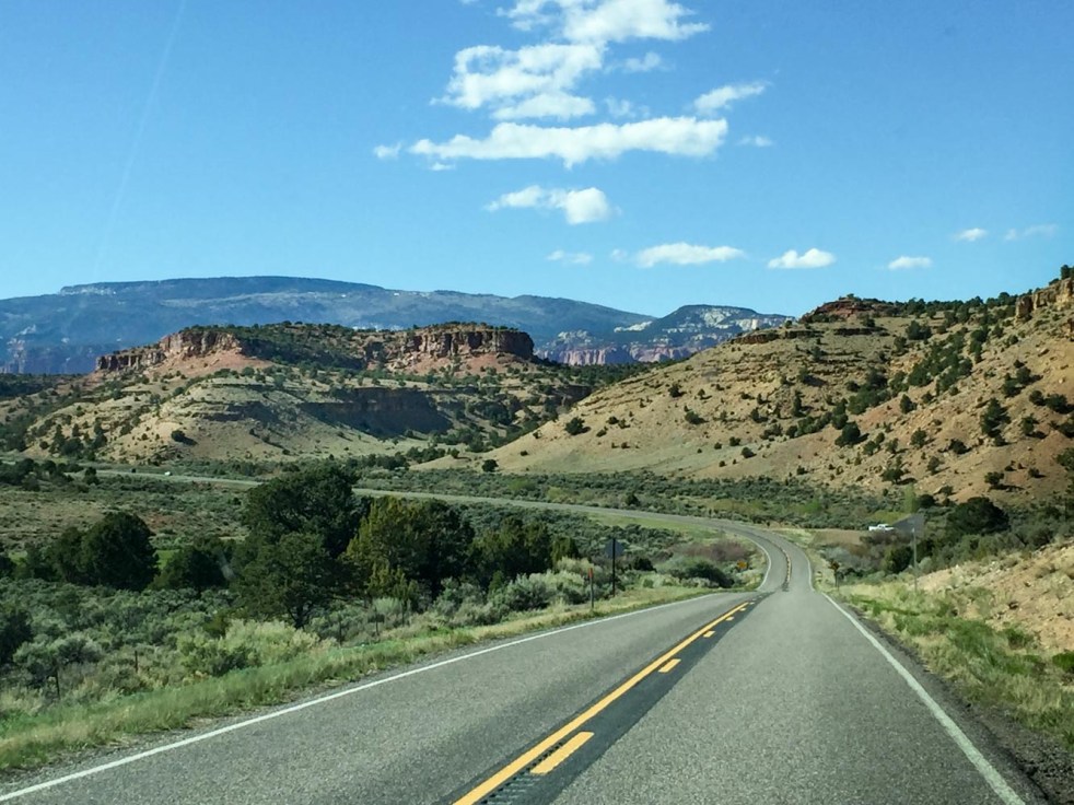
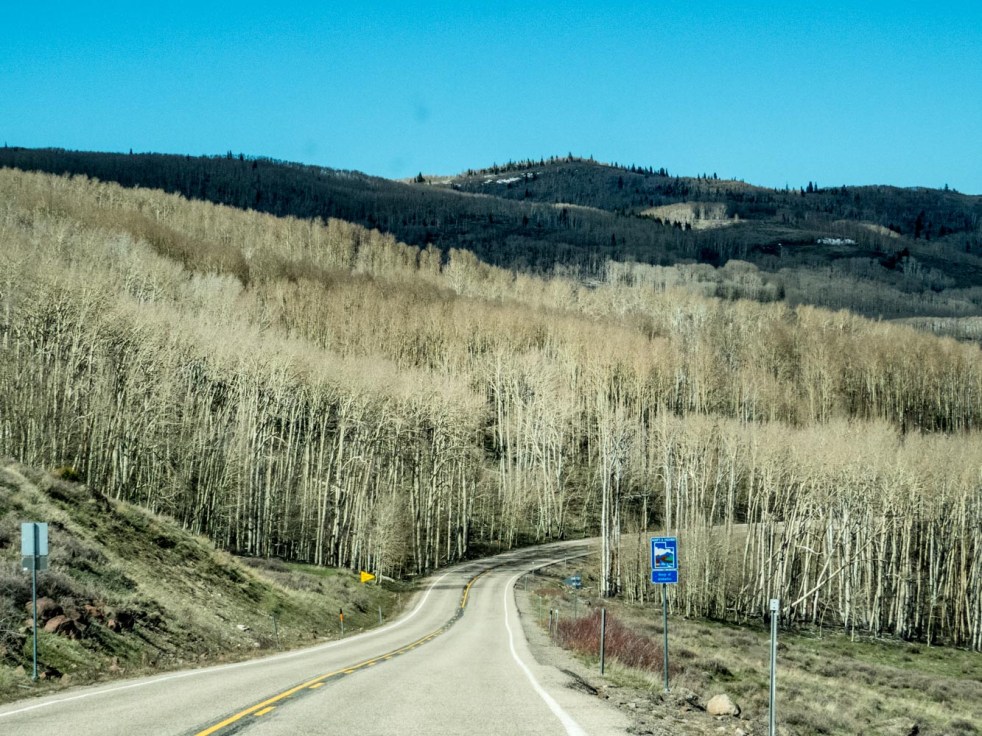
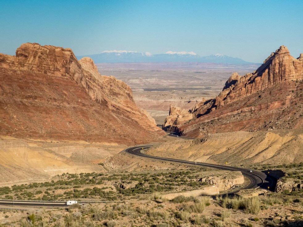
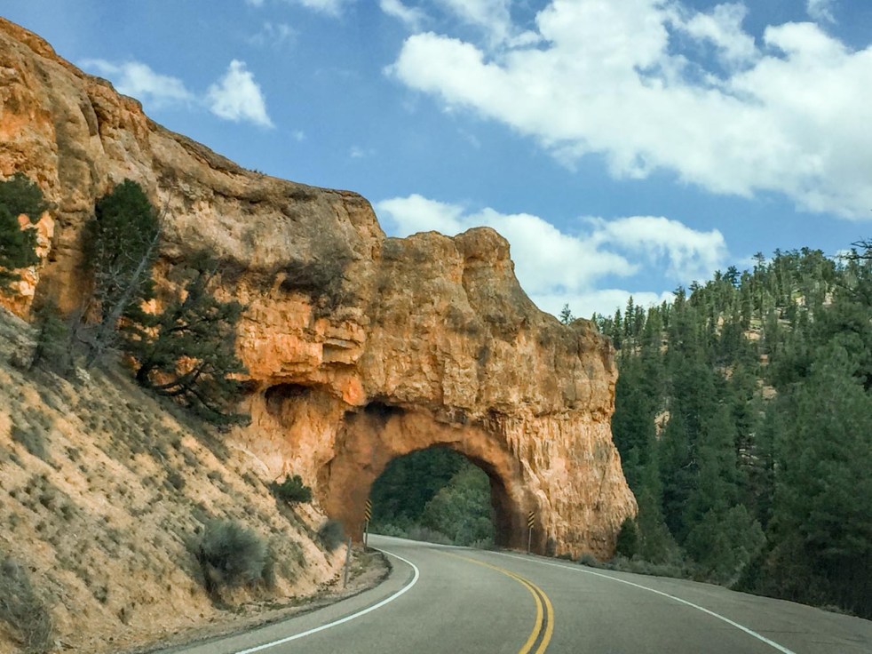
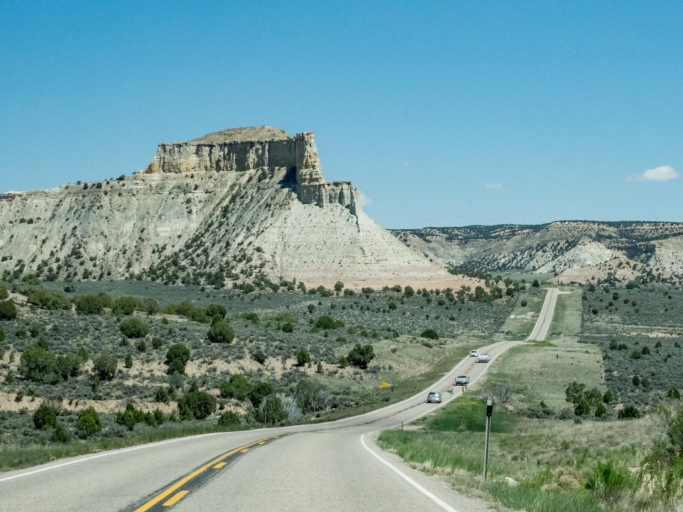 If the glory of the national parks isn’t satisfying enough, driving through Utah between them might add a few more ingredients to your recipe. These were shot meandering between Bryce Canyon National Park and Moab, at a leisurely, completely gratifying pace.
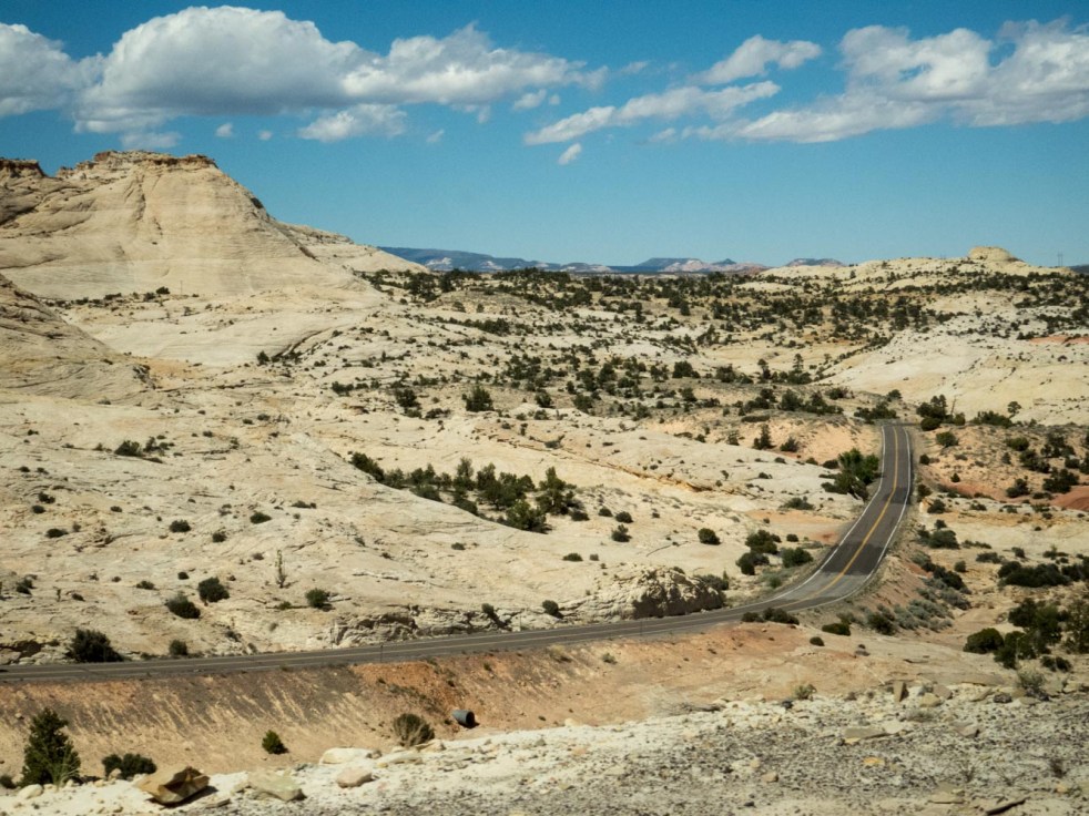


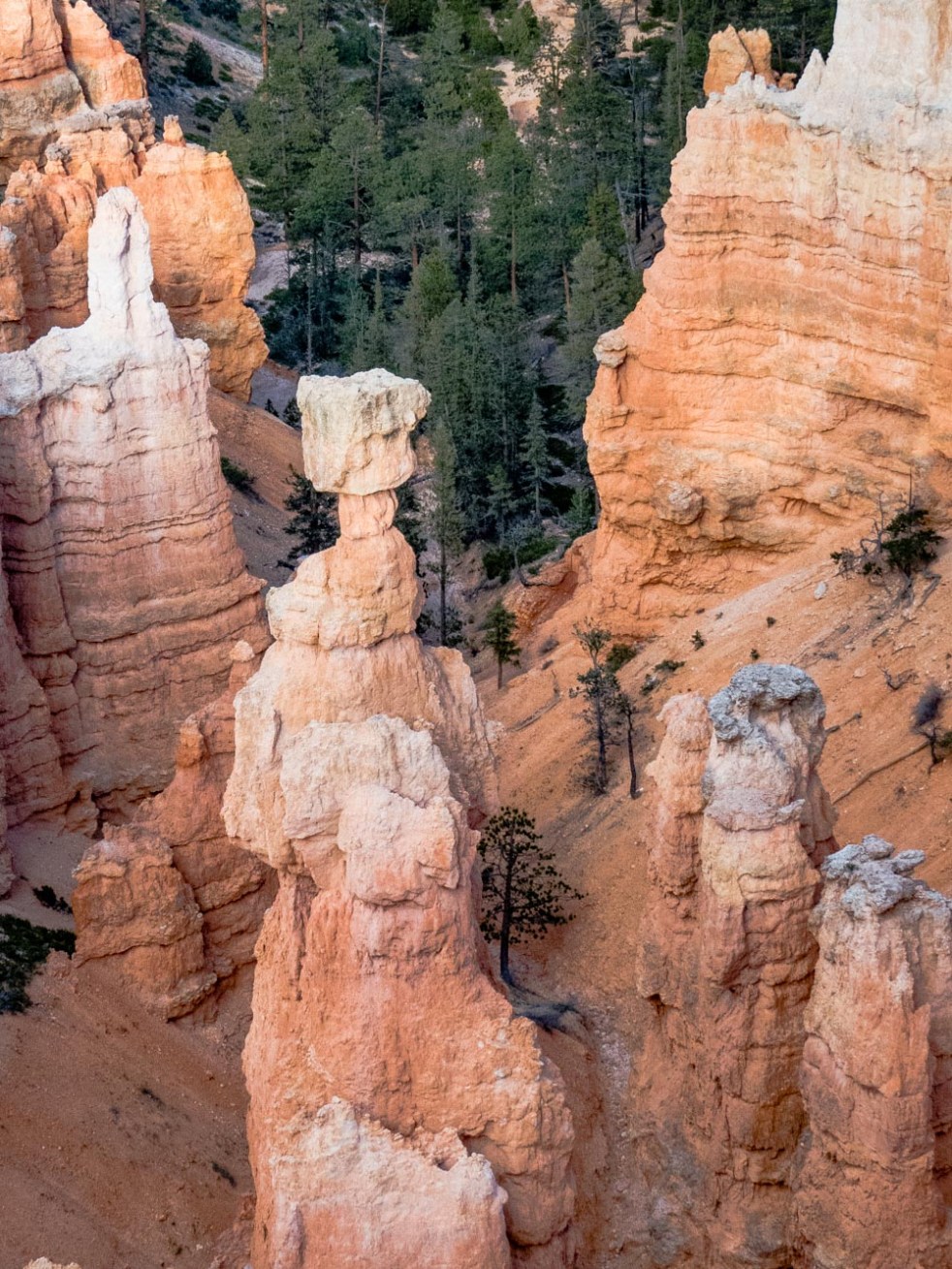
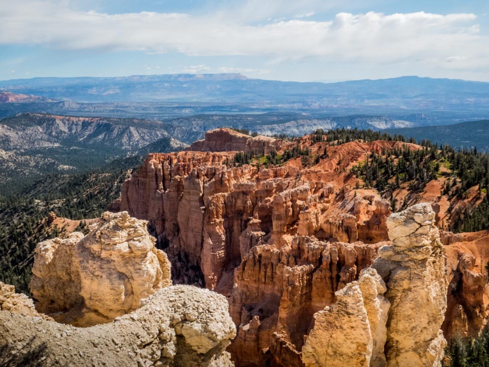
 The amphitheater at Bryce Canyon National Park will take your breath away. The hoodoos, created from layers of soft and hard rock eroded by millenniums of freeze and thaw cycles, have been sculpted into fantasy shapes worthy of any story telling. The following Paiute Indian Legend is posted at the rim of the canyon:


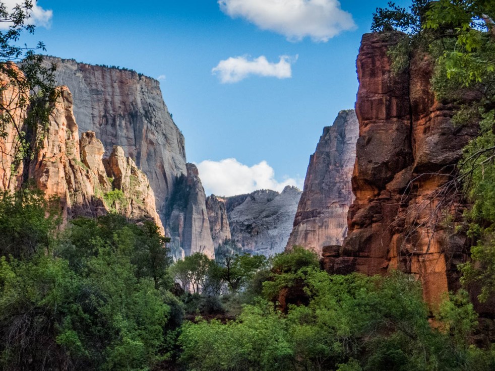
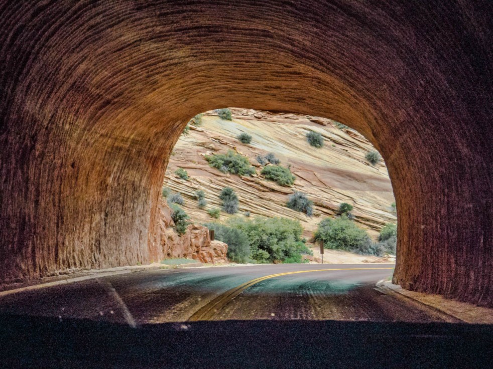
 Whether you choose to define Zion as a heavenly place or a refuge, you’re right. Emerging from the tunnel on the east side of this vast park, you are met with the above introduction to Zion Canyon; the distant road seen at the bottom of the photo leads you there. Every moment spent in this incredible place offers grandeur, color, drama, serenity and wonder, and the opportunity to engage with nature beyond imagination. We barely touched the park’s offerings, and daily blessed those who had the foresight, political will and determination to establish and ensure protection of this national treasure for all of us.